The information for this site has been shared by Guy Simonnot (Simonnot G, 2022) and roughly translated from the French using Google Translate as a starting point. The altitude taken off the MCP QGIS map.
In the wooded ledge (maquis) just above the Arredondo cemetery. Access, however, must be via the Llaneces track and the overlying meadow.
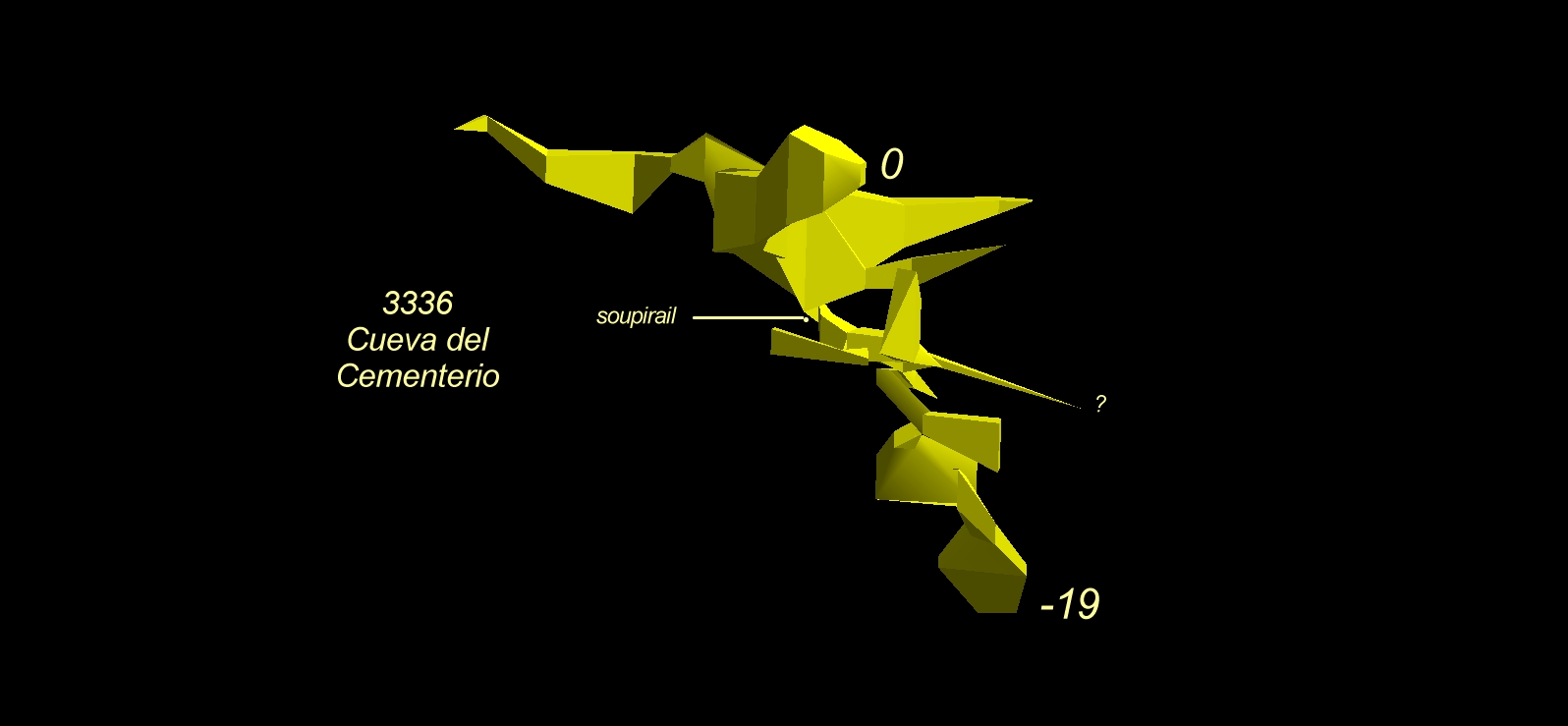
The modest-sized entrance leads quickly to a comfortable gallery, several meters high and with a flat roof established on a beautiful stratum joint. At both ends of the climbs give access to quickly limited extensions. At the end of this upper floor, a narrow passage leads to an intermediate level with a small room where many old, rusty and pierced olive oil cans are piled up!!! A straight duct that could be cleared easily at least shows a continuation for several meters. A new slightly narrow descending passage leads to a third lower level essentially formed of a deep inclined diaclase with clay deposits at the bottom, signs of periodic flooding: elevation -19 is close to that of the río Bustablado.
Known for a long time, the cave was partially visited in 1981 (Guy Simonnot). Then hidden in the invading maquis, it was found by David Gonzalez Cobo in 2019. We have no information on the explorers of the lower galleries. Only a G.I.E. was spotted on a wall in the lower hallway. Topography on May 9, 2021 (David Gonzales Cobo, Guy Simonnot)
Reference: anon., 2022b (Easter logbook); Simonnot G, 2022
Entrance picture : May 2021
Underground pictures : May 2021 and May 2022
Video :
Detailed survey : 3d screen shot
Line Survey :
On area survey :
Survex file :