Updated 3rd March 2003; 22nd May 2017; 30th October 2020
Shaft partly covered with boulders, wood and plastic bags. Stone rattle for
5 seconds. Though tagged in 1990 on the solitary hawthorn tree, there
was no sign of the tag early in 2003. The shaft top will require some time
to open up and it appears to be tight about 3m down.
There are further holes further up the hill and to the west, one of which
is site 1849.
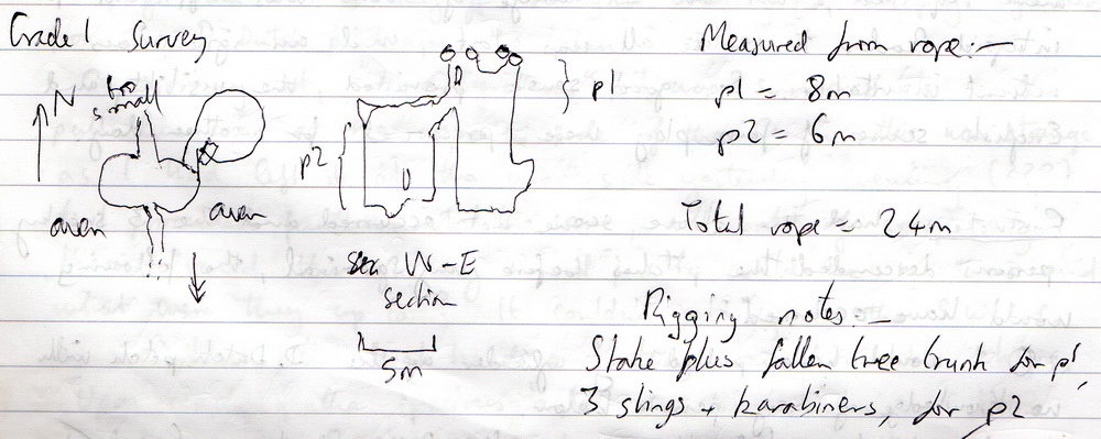
When the hole was visited for exploration in April 2017, it was found to have had the vegetation burnt off, the tree fallen over and area contaminated with diesel. When rigged off a stake and the tree, the initial, diesel-contaminated p8 has a deviation at -5m and is choked at the base with a blind alcove to the east. A "bridge" at -5m slopes down into a parallel shaft which goes to the same depth.
An immature inlet cuts across under twin avens, descending from N to S (into the hill with the dip). This was pushed for a body length to a calcite bulge with an ongoing, small crawl beyond and a large block. There was a "solid" inward draught on a hot day. The rotting calcite could be removed with a hammer and chisel. Upstream goes 4m to where it becomes too small. This was left unentered to preserve floor deposits and features.
The site was found well-covered in October 2020.
Reference: anon., 1990b (logbook); anon., 2003a (February logbook); anon., 2017b (Easter logbook); anon., 2020d (autumn logbook)
Entrance pictures : from 2003 and 2017
Underground pictures: Easter 2017
Detailed Survey : sketch
Line Survey :
On area survey :
Survex file :