On the right hand side of the hill looking towards Cueva de Cobrantes, (110) a small draughting hole enters passage with a number of holes down. A rift descends west and east from a large boulder in the main "chamber". It becomes too tight to the west and closes down to the east after 20m.
The cave is close to Nacimiento del Río Clarín (115).
Reference: anon., 1994b (logbook); Corrin J, 1994b; material in file
Entrance picture :
Underground picture(s):
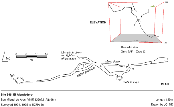
Detailed Survey : 1:500
Line Survey :
On area survey :
Survex file : yes (Amended magnetic declination December 2013 to align with Eur79 grid and coordinates altered to fit ETRS89 datum, April 2014.)