Updated 19th February 1999; 18th January 2004; 31st October 2007; 6th January 2011; 30th June 2018
The entrance lies in a dry valley and the passage heads off into the hill side as a steeply descending boulder slope. A large, clean-washed rift continues with avens on both sides to a 13m pitch into a 10m diameter chamber. The exit is down a tight climb-cum-crawl which requires a rope for the bottom section. At the base are several passages: to the south they become tight in small streamways; to the north both passages end up in the same place. The oxbow passage to the right is steeply descending joins the left hand route at the head of the second pitch.
The 10m pitch lands in a pool and crossing the pools leads immediately to the head of the longest, 23m drop. At the base there are two immature inlets. The way on is in a tight, high vadose passage with a short climb and 3m pitch after some 80m. Sealed with a Kiss rift is about 0.5m wide and is awkward with nodules on the walls. A 3m pitch is followed by walking in a streamway to a junction. To the east is an impassable wet crawl and to the west lies the inlet of Je ne sais pas pourquoi. The passage is a tight rift with a small streamway with evidence of different stream levels. The survey stops at a large amount of calcite flow but the passage continues, becoming tighter until it becomes impassable.
North from the junction continues to a small sandy climb and a rift to the head of a 4m pitch with windows to the right. Directly ahead in the muddy chamber is an unsurveyed link to the further passages. These can also be reached via a tight rift into the Coffee Shop Chamber. A number of routes lead out: the water appears to go along a wide, low crawl to the left with pebbles and flood debris. The crawl becomes tight and immature and ends in a blind sandy crawl. A 2m climb to the left drops into low, wet, draughting crawls.
Through an eyehole and up a sandy ramp leads to walking passage, 2m wide by 3m high. A small chamber has a number of ways off including a climb into the loose roof. The obvious way on is to the right in a dry, wide rift. This continues as high breakdown passage, steeply inclined passing through collapsed chambers. A small trickle enters and sinks and 30m beyond the cave finishes.
There are four ways off at the end. The left route ends at a choke; the centre-left passage is a sandy crawl that closes down; the way straight ahead rises on a nasty boulder slope to an area of loose avens, and the right hand route is a crawl to a small aven.
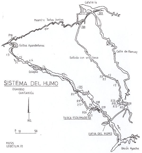
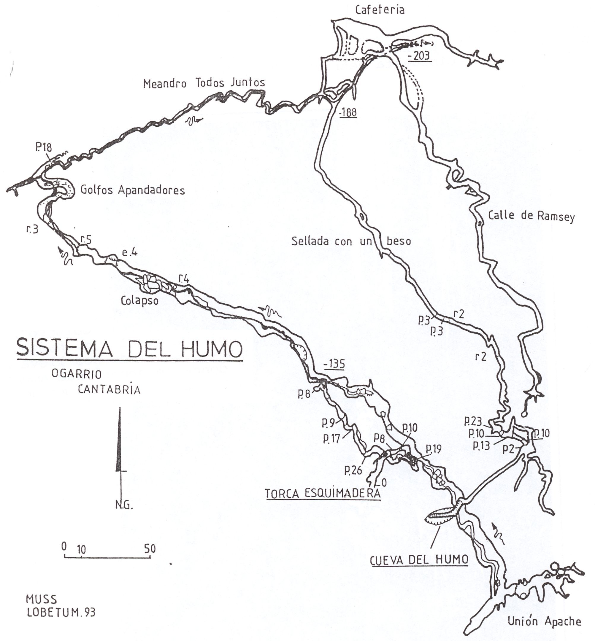
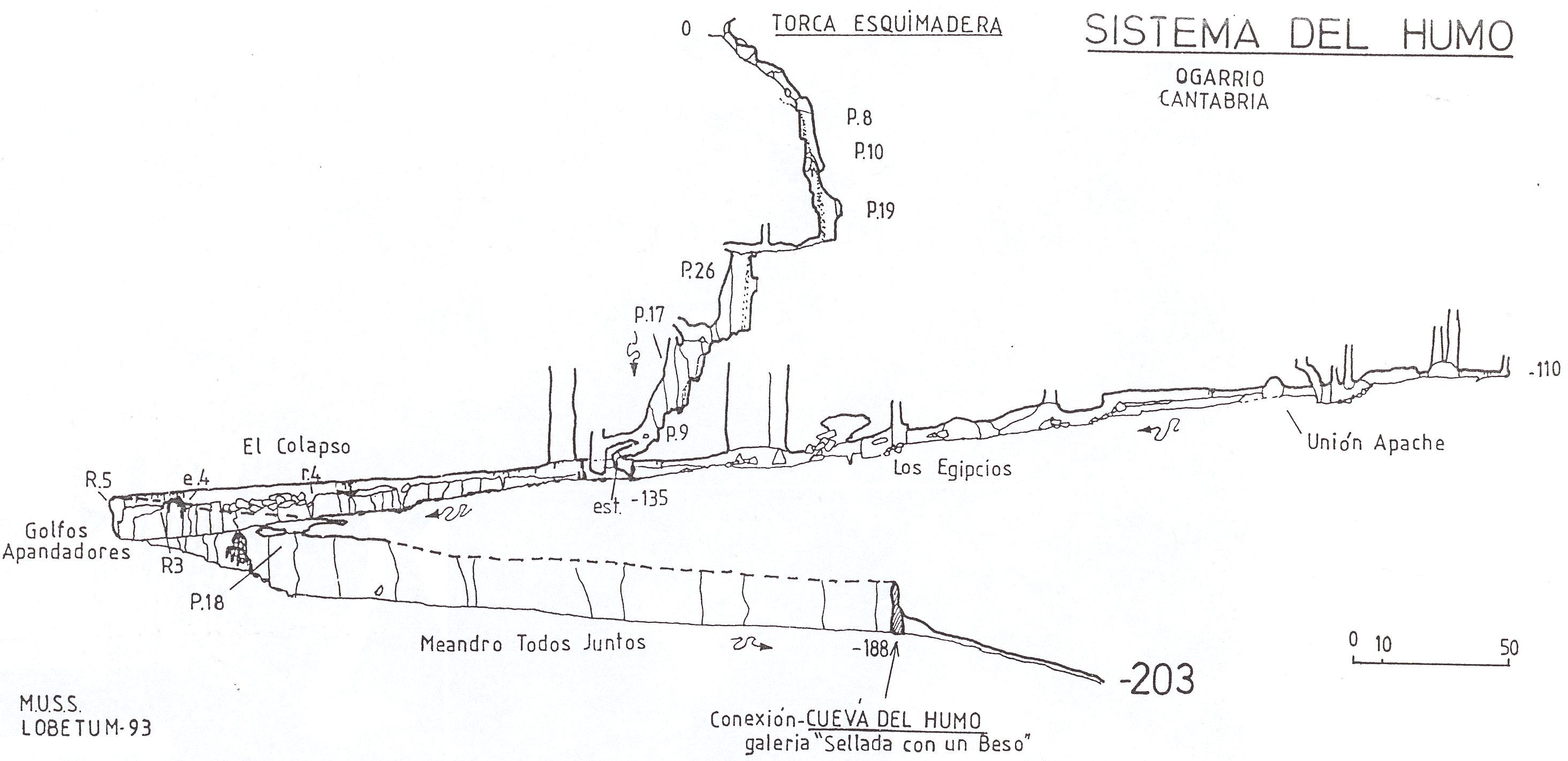
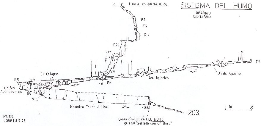
Cuenca cavers in the Asociación Espeleologica Conquense Lobetum have linked Cueva del Humo (734) with Torca de Esquimadera (739) to form the Sistema del Humo with a combined length of 2200m.
References: anon., 1989 (logbook); Corrin J, 1990 (survey); material in file; anon., 1993a (survey); anon., 1994c (survey and photo); García José León, 1997 (survey) ; Valero Enrique y Soriano Ángel, 2007; León García José, 2010 (Volume 1 and Volume 2) (survey and photos)
Entrance picture :
Underground picture(s):
Detailed Survey : from anon., 1993a (AEC Lobetum):
high res system plan low res system plan
high res projected section of Esquimadera low res projected section of Esquimadera
Line Survey :
On area survey :
Survex file : Humo : Esquimadera (Amended magnetic declination December 2013 to align with Eur79 grid and coordinates altered to fit ETRS89 datum, April 2014.)
Passage direction rose diagram: 30/6/2018