Updated 17th April 2002; 9th November 2003; 10th September 2021; 3rd March 2022
The grid reference, once estimated from the GPS position of
site 900, has now been replaced with a GPS reading. (2021)
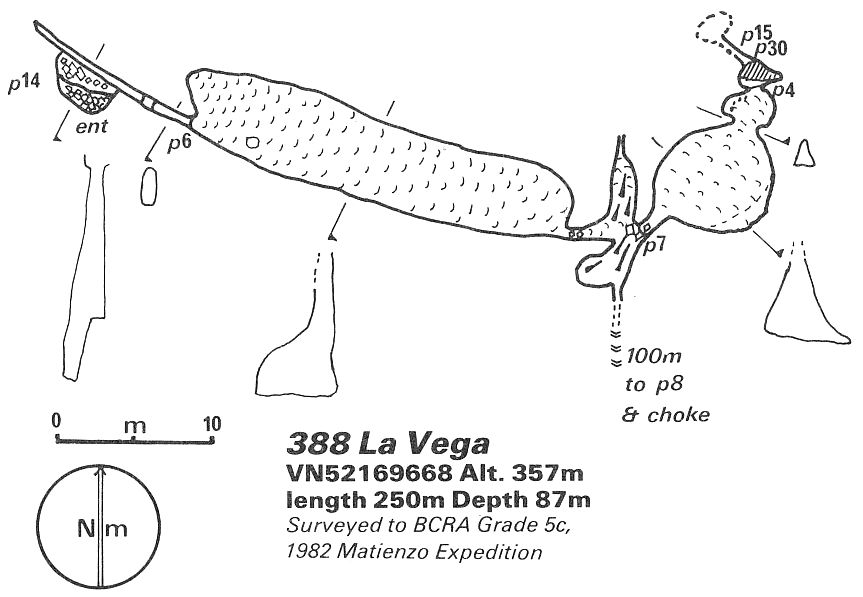
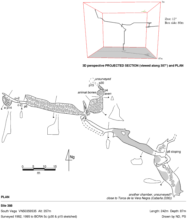
The entrance pitch of 14m is followed by an up-and-down climb of 2m in a
rift to a 6m pitch, landing at the top of a slippery, 5m wide calcite slope.
This ends after 30m at the head of a narrow 7m pitch, at the bottom of which
is a circular chamber with a high aven. Some jaw bones are calcited to the
floor at this point with the exit at the far end being another narrow squeeze
onto a 4m pitch which drops into a pool. A 30m shaft follows and finally
one of 15m which narrows down in calcite.
From the aven chamber a draughting, sandy-floored passage, 150m long, ends at an 8m pitch into a low, wide chamber which chokes in most directions. The draught appears to come from a small aven and various tubes in the roof.
An awkward climb enters passage which continues south and ends in a chamber after 40m with a sandy dig or a promising choke in an ascending passage. This area appears to come very close to Torca de la Vera Negra (036).
References: anon., 1982 (logbook); Corrin J, 1983c (survey); Corrin J, 1983a (survey); material in file; anon., 1995a (Easter logbook); anon., 1996a (Easter logbook); anon., 2002a (Easter logbook); anon., 2021c (summer logbook)
Entrance picture :
Underground picture(s):
Detailed Survey :
| 1982 | known cave | low res | high res |
| 1995 | known cave | 1:1000 |
Line Survey :
On area survey : On scanned 1982 South Vega System survey
Survex file : yes (Amended magnetic declination December 2013 to align with Eur79 grid and coordinates altered to fit ETRS89 datum, April 2014.)
download the South Vega System