Updated 8th November 2003; 21st November 2004; 6th January 2011; 30th June 2018
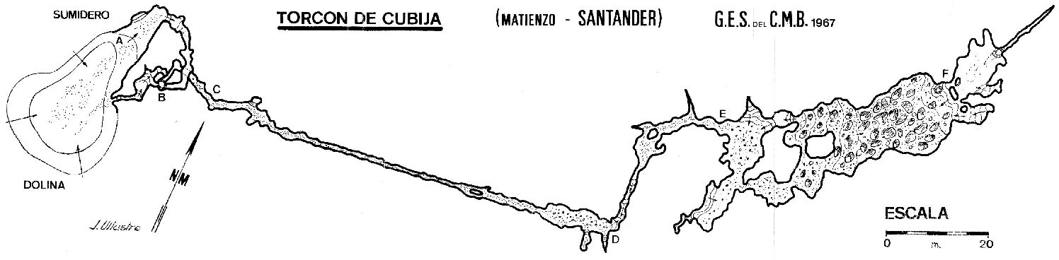
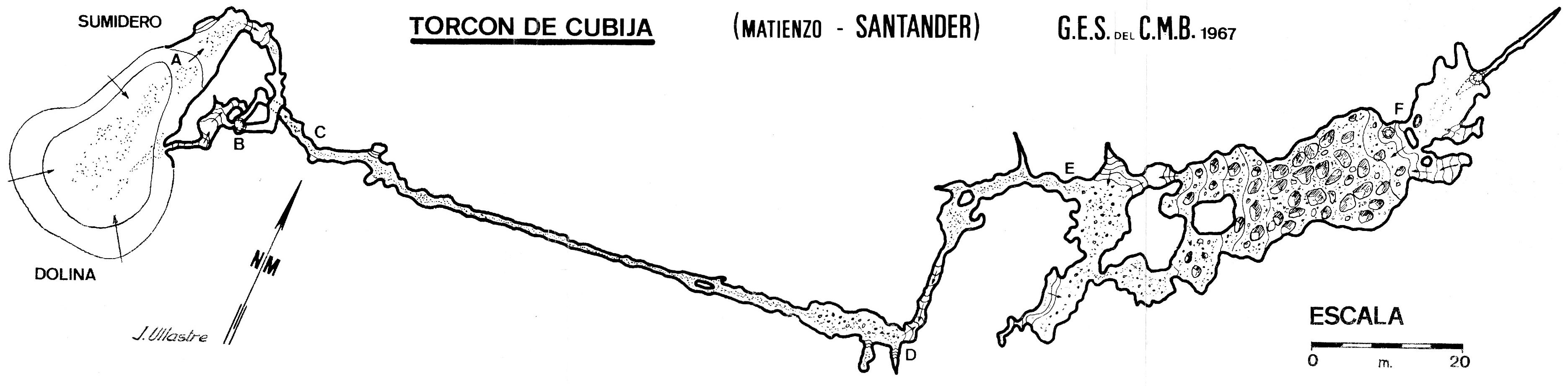
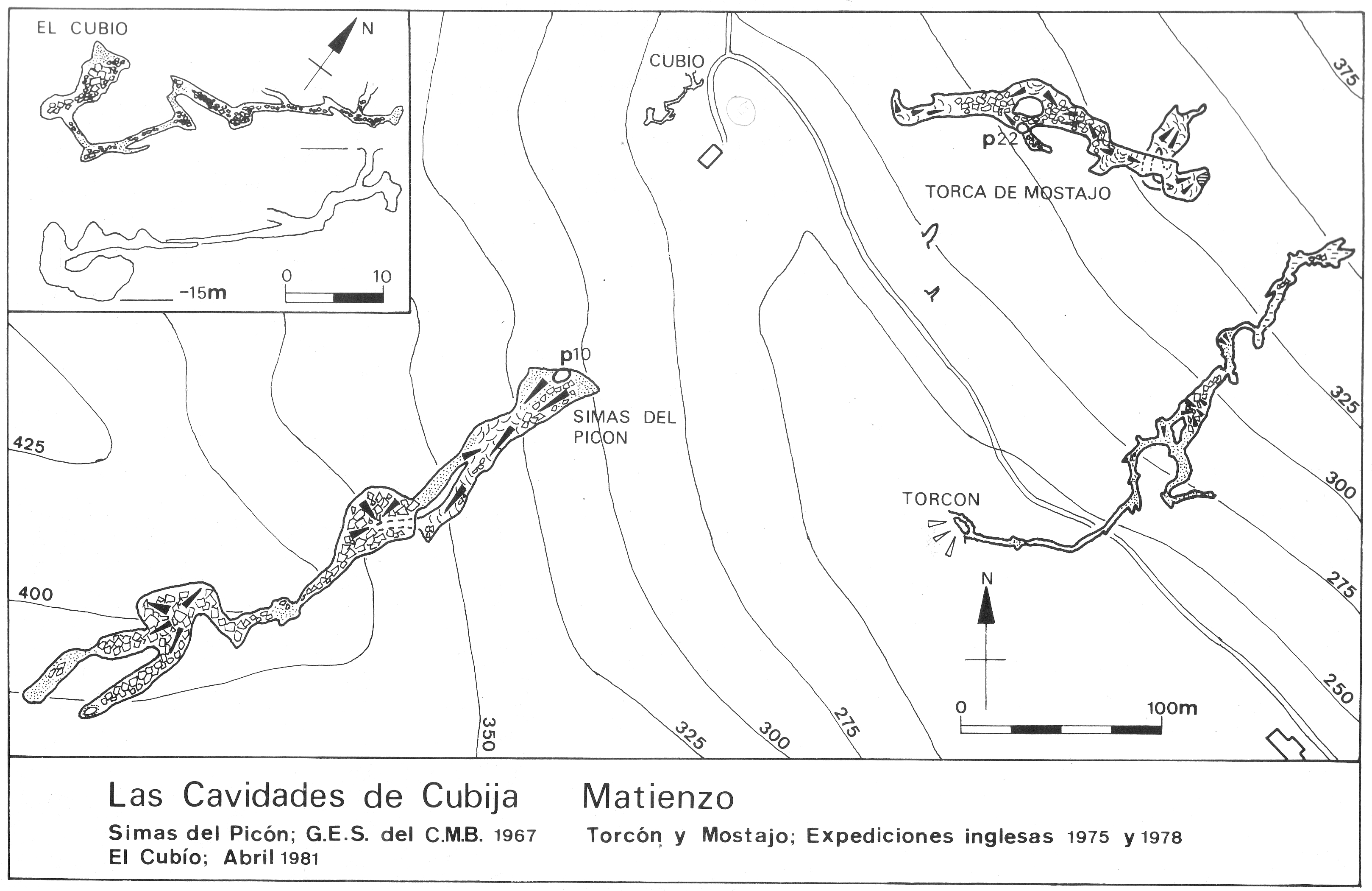
The small entrance is in a large, steep sided shakehole which acts as a wet
weather stream sink. A small passage leads to a 4m climb down and a squeeze
into alternate walking and crawling. After an oxbow the passage enlarges
and a route to the right ends in a muddy choke after 50m. The other direction
leads to a chamber which carries a stream in wet weather. The stream bed
can be followed to a small tube at the far end of the chamber. This ends
at a nicely draughting pebble slope. This was dug through at Easter 94 to
the base of an aven. The extension starts as a clean-washed and narrow rift
and continues through several squeezes, over flakes, to a very small passage
which probably sumps in wet weather. This continues for about 100m until
a (perched?) sump is met at a low chamber. The sump appears to bell out a
few metres down. Thirty metres back upstream, a flatout inlet on the left
hand side has been pushed for about 30m and is still going.
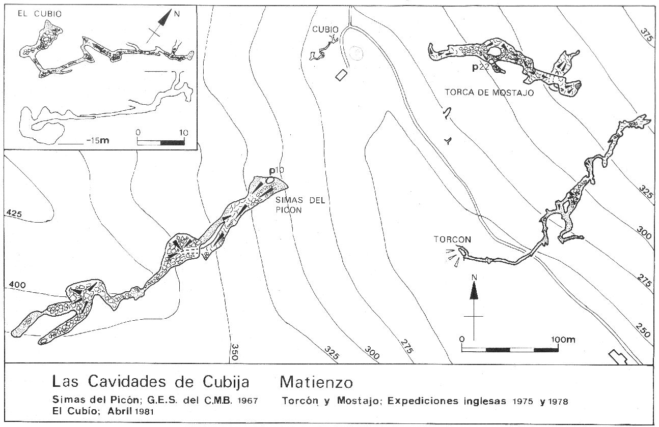
Dangerous climbs above the tube lead to 70m of passage which close down in a heavily pocketed area where the draught is lost.
The dangerous climb can be bypassed by following the draught through a series of crawls into the final section. A draughting squeeze at the end, past a large, unclimbed aven, has been forced to a small, draughty, muddy tube that needs digging.
The aven at the end appears to be within a few metres of the long straw after
the big traverse in Torca del Mostajo (071).
Link to entry in the Cave Diving Sump Index.
References: Kendal Caving Club and Manchester University Speleological Society, 1975 (survey); Ullastre-Martorell J, 1975 (survey and photo); Corrin J S and Smith P, 1981; Smith P, 1981b (survey); Corrin J, 1983c; anon., 1993b (logbook); material in file; Corrin J, 1994a (survey); Corrin Juan, 1995b (survey); anon., 1994a (Easter logbook); anon., 1995c (logbook); Corrin Juan, 1995a
Entrance picture :
Underground picture(s):
Detailed Survey :
| 1967 | known cave | low res | high res |
| 1975 | known cave | low res | high res |
| 1981 | on area map with Mostajo and Picón | low res | high res |
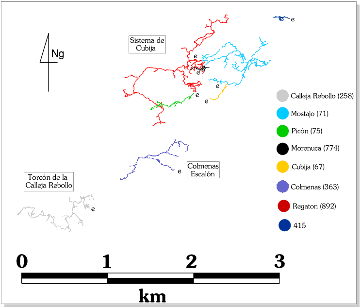
Line Survey :
On area survey : shown on the North Vega System with no detail
Survex file : yes (Amended magnetic declination December 2013 to align with Eur79 grid and coordinates altered to fit ETRS89 datum, April 2014.)
Passage direction rose diagram: 30/6/2018